The City of Lorain is located in northeastern Ohio on Lake Erie, approximately 30 miles west of Cleveland. With over 60,000 residents, Lorain has numerous historical sites and activities to participate in for both residents and visitors and is home to the Charles Berry Bridge, the second-largest bascule bridge in the world.
The Challenge
Like many municipalities in North America, Lorain was utilizing a visual assessment to gather information on the status of its road network. This subjective and labor-intensive method motivated the City to embrace a faster, objective, and transparent way to assess roadway conditions and determine which roads needed repair, along with how and in what order they needed to be repaired. Lorain’s small engineering group was also receiving numerous complaints from residents. “Everyone thinks their street is in poor condition and we needed the ability to properly prioritize maintenance and improvements in a data-driven, scientific approach,” said Guy Singer, Lorain’s Deputy Director of Engineering.
The attribute that the committee believed set StreetScan apart from other vendors was their Streetlogix asset management software.
The Solution
Lorain embarked on a rigorous RFP process to select a pavement management provider and proceeded to interview the top three candidates. StreetScan was selected by a committee. “The attribute that the committee believed set StreetScan apart from other vendors was their Streetlogix asset management software,” explained Singer.
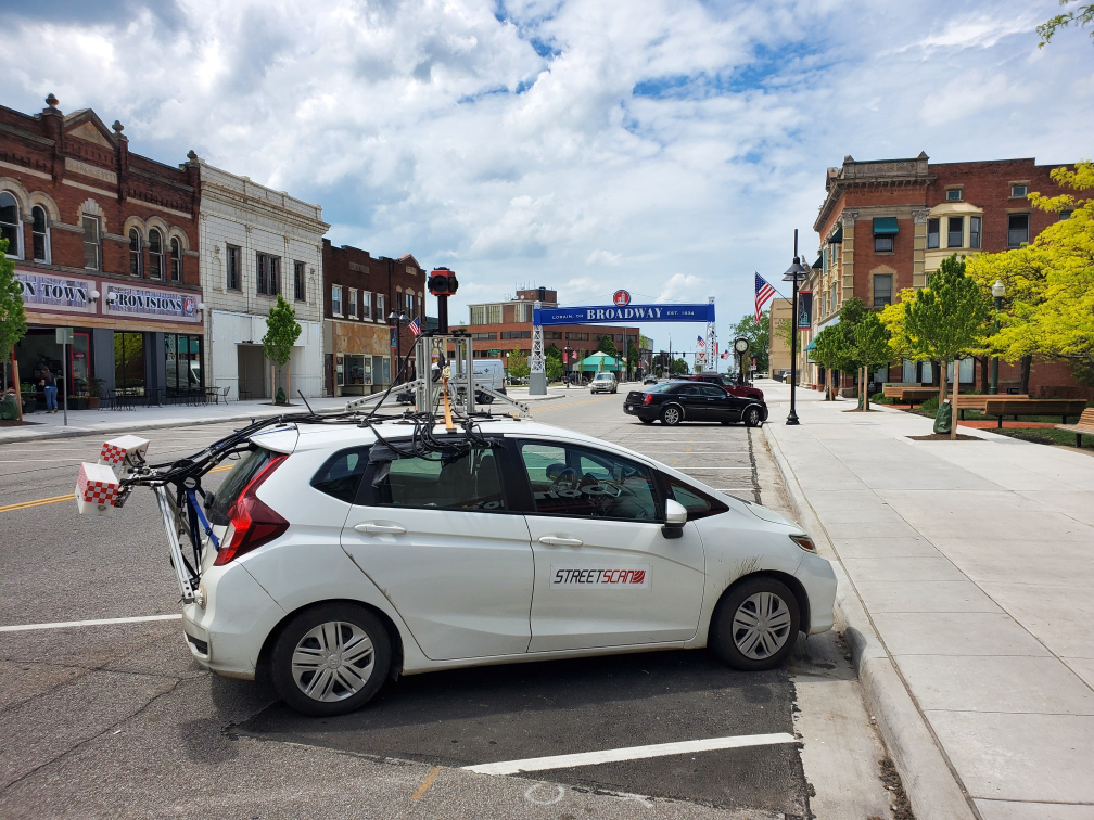
StreetScan performed a City-wide condition assessment using its Smart City Mobile Sensing Technology. This automated method was developed to provide municipalities with a fast, objective analysis, ensuring that repair and maintenance decisions are based on complete and up-to-date data.
StreetScan’s mobile-sensing vehicle travelled 272 centerline miles of roads to assess road conditions in normal traffic flow and, using a pavement condition index scale which runs from 0-100 (with 0 being the worst and 100 being ideal), developed a City-wide inventory of road conditions. The system utilizes 3D imaging technology to aid in the detection of various road defects. The automated detection results, combined with extensive human QA/QC, provided reliable and accurate surface condition estimates.
The Results
Lorain’s overall pavement condition index (PCI) was rated at an average PCI of 66, with 84.4% of the roads above a critical PCI condition of 55. Only 6% of the roads were rated as ‘very poor’ or ‘serious’.
All survey results were placed in the Streetlogix platform, a powerful GIS asset management software that provides the City unprecedented tools to develop capital improvement plans and perform projections on their roadway conditions. Streetlogix AI-engine utilizes PCI, road usage data and a cost benefit analysis to determine road maintenance, repair costs and prioritization per segment. Budgeting and planning tools allow for editable short- and long-term planning as well as level of service analysis with target PCI.
The Benefits
City Staff is now able to interactively share, edit, and view the up-to-date roadway data on a common platform, as well as perform budget planning and develop multi-year capital improvement & maintenance programs. “With Streetlogix, we plan to develop a system that accurately estimates the road maintenance required year to year. This will create an iterative process for us that we believe will improve as we move into the future,” concluded Singer.
