Marshall, Texas is nestled deep into the piney woods of North East Texas, near the Louisiana border. Home to approximately 23,000 residents, this charming city is a cultural and educational center and is known for holding one of the largest light festivals in the United States.
The Challenge
Whether it be budget limitations, pressure from district council members or resident complaints, the task of effectively developing a long-term maintenance plan for its 200 centerline miles of City roadways was becoming very difficult. Plus, with tighter budgets and rising material costs, the City needed a more technical approach to develop a repair and maintenance plan; one that would create a baseline dataset to build the plan from, while also remaining free from political or resident pressure.
We now possess the ability to prepare an extensive long-term plan for road maintenance activities that eliminates outside influences.
The Solution
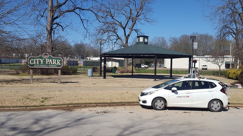
The City embarked on a search for an objective and cost-effective way to assess roadway conditions. The City selected StreetScan to perform a City-wide condition assessment using its Smart City Mobile Sensing Technology. This technology has been developed to provide municipalities with a fast, objective analysis, ensuring that repair and maintenance decisions are based on complete and up-to-date data.
“If my staff and I had attempted to complete this kind of detailed analysis of 200 centerline miles of roads, it would have taken us every bit of two years to develop the dataset and still would not have been to the level of accuracy that StreetScan provides,” mentioned Eric G. Powell, PE, Director of Public Works and City Engineer for the City of Marshall.
StreetScan’s mobile-sensing vehicle travelled 200 centerline miles of roads to assess road conditions in normal traffic flow and, using a pavement condition index scale which runs from 0-100 (with 0 being the worst and 100 being ideal), developed a City-wide inventory of road conditions. The system utilizes 3D imaging technology to aide in the detection of various road defects. The automated detection results, combined with extensive human QA/QC, provided reliable and accurate surface condition estimates.
Once scanned, results were made available in Streetlogix, a powerful GIS asset management platform that provided the City unprecedented tools to develop capital improvement plans and perform projections on their roadway conditions.
The Results
All survey results were placed in the Streetlogix platform. Streetlogix AI-engine utilizes PCI, road usage data and a cost benefit analysis to determine road maintenance, repair costs and prioritization per segment. Budgeting and planning tools allow for editable short- and long-term planning as well as level of service analysis with target PCI.
With Streetlogix, the City has an enriched view of its street network with color-coded pavement conditions and other assets, along with images for every road and tools for data-driven budget and maintenance planning.
StreetScan reported that Marshall’s overall pavement condition index (PCI) was rated at an average PCI of 53, with 46% of roads above a critical PCI of 55 and 37,5% of roads rated as ‘very poor’ or ‘serious’. Staff were pleasantly surprised at the average PCI but concerned over the extreme condition rating of some of their streets.
The Benefits
Having a comprehensive view of the overall condition of City-owned streets is an important benefit for Marshall. It allows Staff to have PCI data at their fingertips, build different scenarios in minutes, and quickly respond to resident inquiries. “We now possess the ability to prepare an extensive long-term plan for road maintenance activities that eliminates outside influences. The data and PCI are our method of selection and organizing. Plus, having the ability to plug in our unit prices to determine annual costs of services and treatments means that we can better plan for the work and stay within existing budgets, and maybe even increase the budget requests as we show the PCI improving,” explained Powell.
The City is now utilizing the data created by the initial scan to develop a 10-year street maintenance plan and will utilize the unit price tools to help align the plan with current budgetary monies. Once approved by the Council, the plan will be a quick and easy way to review the street improvement budget each year and eliminate any “surprise” years.
“I would absolutely recommend StreetScan to any city that wants to get a good handle on the condition of their streets, evaluate that condition and assign budget numbers to it. Streetlogix’s ease of use makes planning quite simple and takes the guesswork out of prioritizing and preparing,” concluded Powell.
